
26 February to 5 March 2024
Deshaies, Guadaloupe to Jolly Harbour, Antigua, 17° 4′ 75″ N, 61° 54′ 05″ W, 48nm, 8 hours 30
to Green Island, 17° 4′ 18″ N, 61° 40′ 25″ W, 21nm, 5 hours 30
to Jolly Harbour, 17° 4′ 75″ N, 61° 54′ 05″ W, 22nm, 3 hours 30
to Buggs Hole, St Kitts, 17° 13′ 15″ N, 62° 39′ 58″ W, 47nm, 8 hours 30 minutes
to Simpson’s Bay, Sint Maarten, 18° 2′ 18″ N, 63° 6′ 23″ W, 54nm, 11 hours 30 minutes

Arriving anywhere unknown in the dark is far from ideal but when the water is as shallow as the approaches to Antigua with all its shoals and reefs, arriving at night is foolhardy by anyone’s standards. But having left Guadaloupe in the late afternoon, we found ourselves arriving at around midnight in the pitch dark.
Creeping into the open anchorage at Jolly Harbour, I navigated the hazards that were charted (hoping they were accurate) and those that weren’t. Like our approach to Rodney Bay, it was hard to make out which dark lumps were land and which were boats. Stefan got out the torch to help judge distances but it didn’t help when he said “that looks like a fishing boat run aground” Already in only about 5 metres of water I declared it time to drop the hook. I didn’t fancy picking our way through anchored boats in the pitch dark at unknown depths!
When we woke, of course, in true Pintail style, we were miles away from the other boats and the aground fishing boat was, in fact, a perfectly floating trawler yacht.
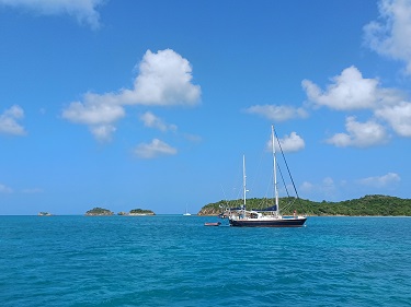

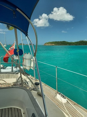
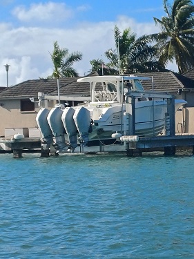
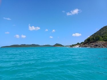
In the light of day we moved further into the anchorage and our shallowest spot yet at only 1m under the keel. The water was so clear and bright aquamarine.
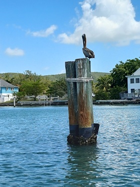

Stefan disappeared to check us in at customs and immigration and returned about an hour later declaring the officials, contrary to reports, to be the friendliest and most efficient he had encountered so far and better still their dinghy dock was the best yet. Even the pelicans were welcoming!


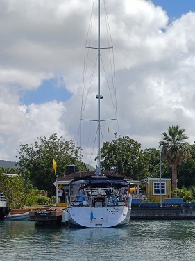
When we ventured ashore together we found Jolly Harbour to be a vast contrast to the places we have stopped at in the Caribbean so far. In fact it didn’t feel at all Caribbean. Rather, it looked much how we imagine Florida will look – all million dollar waterfront properties with yacht pontoons. The supermarket certainly came with a similar price tag but it did have a much more diverse product range than we’d become used to including some from Waitrose! There was also a well stocked chandlery and some cafés and restaurants but it was all lacking anything resembling a soul.
However, in the gorgeous waters of the anchorage, we bumped into Carol and Steve on Innamorata II again. We really enjoyed their company and their wisdom about all the best spots in the Caribbean. The best thing too was that they had been up the East Coast of the US before and had plenty of recommendations for places to go and yards to leave the boat in. They were also heading that way this year so we had ourselves a buddy boat!!
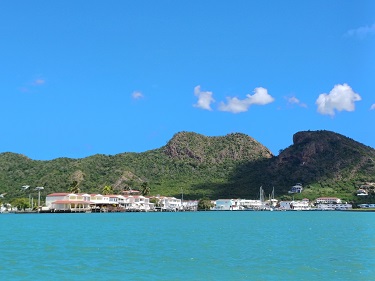
One of their recommendations for Antigua was the anchorages on the west coast of the island. Smaller islands and reef systems provide protection from the prevailing wind and waves. With some stronger winds forecast in a day or so we decided to sail round and sit them out in this remote area.

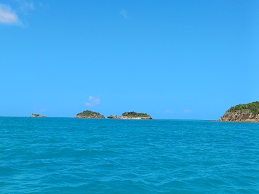
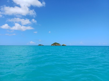
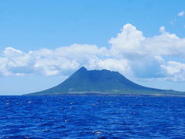
We sailed passed the popular spots of Falmouth and English Harbour, where Nelson had docked on his visit to the island, and found a great spot in the lee of Green Island. There were a few other boats there but we were significantly outnumbered by the resident turtles.
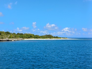


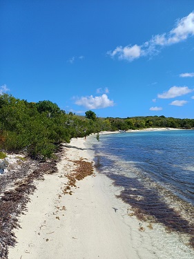
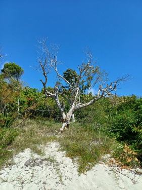
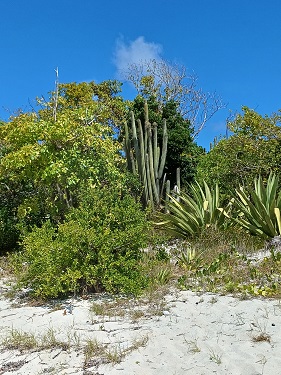
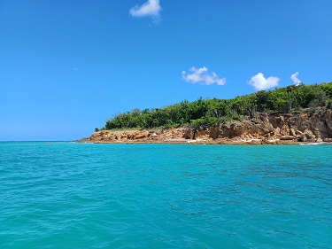
We enjoyed a restful couple of days off Green Island. We were completely protected from the wind by the island and from the waves by a long reef coming out from it. We couldn’t go very far. We could only land the dinghy on the beach and walk along the sand. The interior was guarded by thick scrub. Mostly we just swam, snorkeled and watched the turtles.

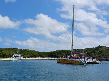


Every day at around 11am a number of tourist boats would invade our little island and disgorge big groups of snorkelers. They were then route marched around the reef by sergeant major like guides. Stefan took to calling them ‘the guppies’ because they moved passed us like a big shoal of fish. They left by 1pm, leaving us in peace again.
Our time to get up to 37° North before hurricane season was by now ticking fast and with not much to interest us on Antigua we decided to make a long hop up to Saint Martin/Sint Maarten. Going all the way it would be an overnighter so we decided we would break the journey at Saint Kitts. Technically if we stopped at an island we should check in formally with customs and immigration but we thought we would just try to anchor for the night and leave.


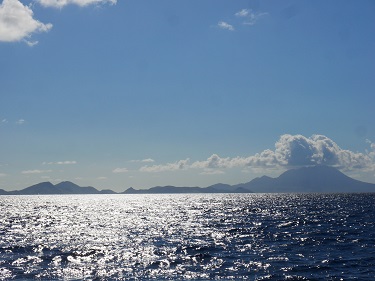
We left Antigua with a big dark cloud above it at dawn and soon the island of Monserrat was just about visible to port. It is possible to anchor in the north of Monserrat but following the eruption of its volcano in 1995 which destroyed its capital, Plymouth and caused the evacuation of most of the population. An exclusion zone still stretches across the southern end of the island and travel is therefore very restricted so we carried on towards St Kitts and Nevis.

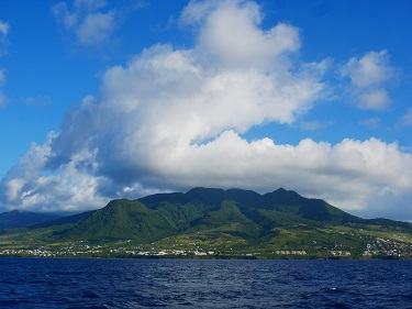
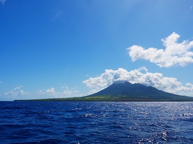
It was another great sail, although a little bouncy with the open ocean swell on our beam, and soon another volcano was in sight. Nevis’ 985 metre high volcano last erupted some 100,000 years ago and apart from some minor rumblings all has been peaceful on the island since.

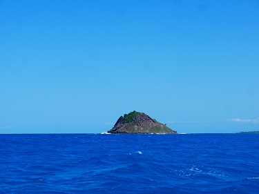
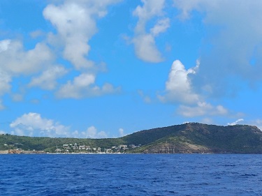
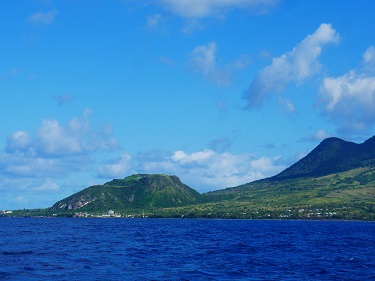
We got a closer look at Nevis Peak to port as we navigated the channel between Nevis and St Kitts. In the middle of the channel is Booby Island. It is probably named because it is home to seabirds including brown boobies but it also does look rather like a boob! To starboard we had a view into the landscape of St Kitts and its highest peak, Mount Liamuigia.
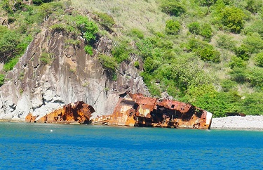

We rounded the south east end of St Kitts and found calm water to anchor in Buggs Hole. We hoped it would be remote enough for us not to attract attention from the authorities. If it did we would just check in to the island formally the next day. On the shore was the wreck of a ship that had been sunk and then washed ashore by a hurricane. Another reminder of why we were pushing on to get north!
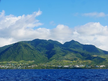
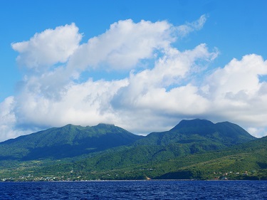
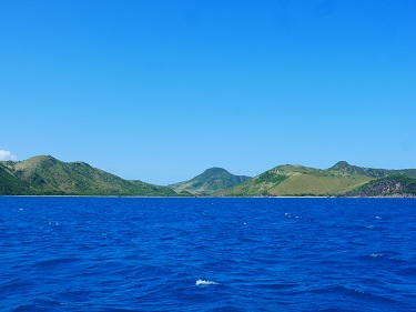
In the morning, without having had a visit from customs, we continued on our way in the lee of St Kitts. We had an amazing front row view of the island’s topography and back towards Nevis in the distance.

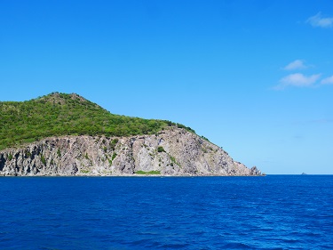
At the western end of St Kitts, even from offshore we could see an unusual feature. There appeared to be a volcanic plug close to the shore with a crater. The closer we got the more we were convinced there was something built inside it. A short bit of research taught us that this natural vantage point had been used by the British to build a fortress tucked inside the crater. Brimstone Hill Fortress kept the French out until 1853.

A little passed Brimstone Hill Fortress we turned north into the channel between St Kitts and the Dutch islands of Sint Eustatius and Saba.


Our route took us passed Sint Eustatius. It appeared an island of two halves – the 600 metre high crater of the Quill, another dormant volcano, at the east end and the lower peaks of the Boven National Park at the west end.
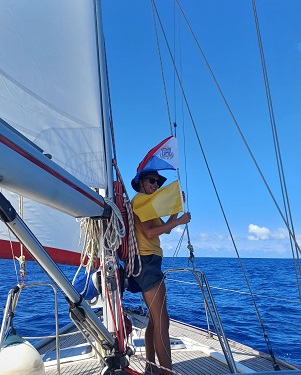
Later in the afternoon we passed by low, thin Saint Barthelemy, another French island known to Brits as St Barts, but we raised the flag in preparation for landing on our first Dutch territory, Sint Maarten.


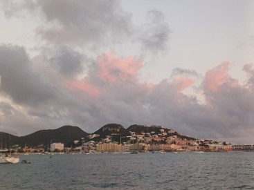
Arriving in the busy anchorage at Simpson’s Bay as the sun went down, from the boat it looked, well, just a little bit Benidorm – all high rise resorts and not even remotely Dutch or even Caribbean looking. But a closer exploration was going to need to wait until the morning…
